The Archaeology of Pennyhooks Valley

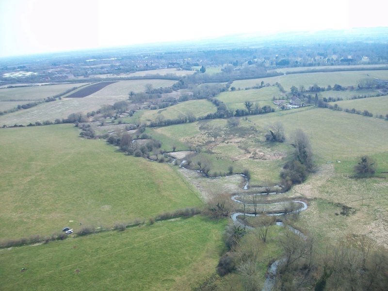
Picture 1. Pennyhooks Valley viewed from the West looking towards Watchfield village.
When we first started investigations into the Cold Bath site at West Mill, (see page of that title) little did we know of the chain of events that were about to unfold. What started off with the exact date of 1767 when the Vicar of Shrivenham, Barfoot Colton, built the Bath House, has now ended up several thousand years earlier.
The site of the Bath House and its incorporated use of the Spring water, was completely overgrown by fallen Willow trees and Brambles. In order to be able to see what might remain of the buildings foundations, it was necessary to clear the over-burden. The results of the survey and limited excavation can be seen on the Cold Bath page.
Whilst clearing debris away from the spring water run-off, it was noticed that there were numerous pieces of flint. At that time, none of us involved in the excavation had sufficient knowledge to identify if the flints were ‘worked’ or just debris brought in by the builders of the Bath House. After some study it soon became clear that the majority of the flints were flakes that had been knapped from larger pieces. It took little imagination to then speculate as to who else may have used this particular location historically.
With the kind consent of the farmer Adam Twine, a series of Test Pits, 1 metre by 1 metre were dug through the Winter of 2012/13 in the field adjoining the Spring to the North. Almost immediately the over-whelming picture became one of flints found in the majority of the pits. Flint is not a natural material that is found in this area, so its presence meant that it had to have been transported here. It was clear that this area had been used or occupied by man from a very early period.
The study of flints became a steep learning curve and I found myself increasingly fascinated by the Lithic Art. I soon discovered how difficult it is, even to the world’s experts, to date a flint as an individual artefact. Certain styles of preparation and particular morphology (shape) help to attribute recognisable tools to wide historical periods in history. But unless found in a stratified context with other more readily dateable material such as organics, it remains difficult to date accurately.
By Test Pit number 30 we were beginning to get some idea though of where our flint assemblage might have originated in history. At this moment in our studies, it would be reasonable to claim that the assemblage dates from the late Mesolithic to the Early Neolithic (approx. 6000 years old). The investigation continues and I will update this chronicle as more is discovered.
Click here to see a selection of Flints.
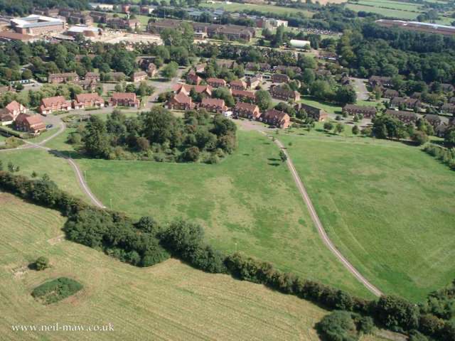
There is an area in the South of the parish known locally as ‘The Folly.’ It is a curious description when compared to other areas that have similarly named places, as they generally refer to a building that is peculiar or has some oddity about it. All we have at Watchfield Folly is a small hill, a ditch or hollow and a Second World War Air Raid Shelter. It is located immediately behind the earlier military housing with the newer houses built closer to it. (Grid Ref: SU9040 2490). It appears to have no significance at all and one wonders if the depression in the ground was merely caused by minor quarrying. When the By-pass was under construction in 1983 an Anglo Saxon cemetery was discovered just north of the Folly. (See chapter, The Saxons) During the excavations archaeologists discovered evidence of occupation in the form of worked flints from the late Mesolithic period approx 5,000 BC, continuing up to the early-middle Iron Age, 750 - 300 BC. Therefore, it is fair to assume that this area was deemed of special importance to the early inhabitants of Watchfield, but if it was for any particular reason, we don’t yet know what it is. The Magnetometer Survey carried out in 1985 showed a large number of features in the form of pits and ditches. One in particular would suggest a boundary ditch, very possibly enclosing an Iron-Age settlement, whereby the By-Pass A420 runs right through the middle of it. (See Picture 5).

Picture 2. Watchfield Folly, an enigmatic depression on top of a small hill, now covered in trees. The hedgerow running across the picture is an ancient trackway
Before the Roman invasion, Watchfield was located within the boundary of the Celtic tribe known as the Atrebates. Its capital was modern day Silchester, located South of Reading and known in the Roman period as Calleva Atrebatum. However, Watchfield is very close to another tribal boundary, that of the Dobunni of Gloucestershire. There is evidence of a Celtic settlement in the area to the West of the village with pottery scattered about the fields there, which enhances the findings of the archaeologists at the By-pass site nearby.
There are several sites within the parish that contain evidence of Roman occupation. An English Heritage report states that a Roman building was excavated on the west side of Little Wellington Wood in 1903. (Picture 6) The excavations revealed foundations of buildings, a Well and a stone drain running away from it. Numerous artefacts were also uncovered including bricks, pottery and coins, which dated the occupation to the third and fourth centuries.
More evidence of Roman occupation came from a site less than a mile away in another wood called Squires Copse, at location, (Grid Ref: SU8970 2460 ) I can write with authority on the discovery as I was there at the time. Myself, and a friend called Terry Wickel were busy digging in the mud along the bank of a bend in Tuckmill Brook. We had previously discovered many bones protruding out of the bank by the water line. The bones were huge and probably belonged to a cow or a horse. Whilst I was busy with the bones, Terry was investigating a patch of particularly soft mud. On one of his thrusts with the spade an object suddenly rose to the surface. It was a clay pot, grey in colour with a handle and a crude pattern around its circumference. (Picture 3.) With no archaeological knowledge whatsoever, we did what most 13 year old boys would do. We emptied the mud out of it to see what was inside! To our dismay and untrained eyes it contained nothing. The experts at Reading Museum confirmed it was Roman and dated it to the 3rd century. The discovery spurred us on to dig around even more and others also joined in. About two feet down below the mud bank we also discovered large flat timbers. We were unable to determine just what the timbers were part of so maybe future archaeologists will shed light on it. Some time later and very close to where the Roman pot was found, another local lad called Clive Norman - Thorpe found an iron spear head. (Picture 4). So, this spot is worthy of future investigation.
During the construction of the A420 By-pass, an unconfirmed report stated that evidence of a small Roman building was discovered on a flat part of a field just before it slopes down to Pennyhooks Brook. (Grid Ref: SU9035 2395). Having been given this information, I visited the site soon after the completion of the By-pass and found evidence mainly in the form of iron shoe studs and small fragments of pottery. However, I can only assume that remains of any building that might have been there, have now been removed by the road construction.


Pictures 3 & 4. Roman pottery Jar and iron Spear Head dated to the 3rd Century A.D. found in Tuckmill Brook